Shark Aviation

Shark AERO

Monitor field conditions using multiple data sources

Review in-field measurements, remote-sensing data, weather, and field history together.

No single data source shows the whole field

Soil moisture, crop cover, weather, and historical records each provide part of the picture. Shark AERO connects these sources to the same field record so they can be assessed together.

System model

One shared data record for each field

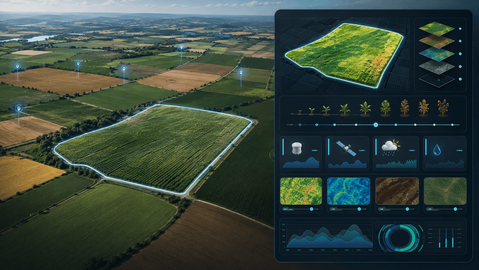
Each mapped field has its own record. Sensor measurements, multispectral observations, weather, and historical data are connected to that record and used to produce analyses and alerts.

  1. 01

    Field sensors

    Continuous measurements from Shark-engineered probe infrastructure installed in the field.

  2. 02

    Remote sensing

    Multispectral and satellite observations linked automatically to mapped parcels.

  3. 03

    Weather

    Location-specific conditions and forecasts interpreted with field and spectral data.

  4. 04

    Field history

    Prior seasons, events, and measurements that contextualize current readings.

Combined field data

Shark AERO

Outputs

  • Irrigation decision support
  • Crop health indicators
  • Disease-risk early warning
  • Soil and vegetation analysis
  • Field alerts

Workflow

How field data is processed

Define the parcel, connect data from multiple sources to the same field record, and identify changes that may need attention.

  1. 01/Map the field

    Define parcel boundaries and create a persistent digital field profile.

  2. 02/Observe

    Collect probe measurements, remote-sensing layers, and weather context.

  3. 03/Combine

    Associate every source with the same field entity and time window.

  4. 04/Analyze

    Derive moisture intelligence, vegetation indicators, anomalies, and risk signals.

  5. 05/Show

    Present recommendations, warnings, and timelines on web and mobile.

Field sensing

Probe infrastructure engineered as a complete system

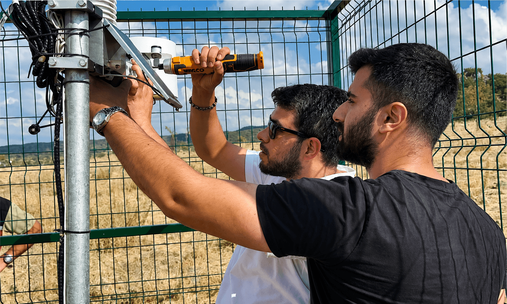
Shark Aviation designs and integrates the field sensing platform: probe architecture, electronics, communication, acquisition, device management, and backend storage. Individual sensor elements may come from specialized suppliers. The complete in-field system and its data path are Shark-engineered.

  • Install in agricultural fields for continuous field-level measurement
  • Acquire and transmit data under agricultural operating conditions
  • Manage devices and integrate backends as part of the platform
  • Store data against the digital field profile, not as orphaned device logs

Field mapping

Every parcel becomes a digital field profile

You map agricultural fields inside Shark AERO. Each field is a durable record. It accumulates sensor measurements, satellite observations, spectral indicators, weather context, crop information, and generated insights over time.

Remote sensing

Spectral and satellite observations on the same field model

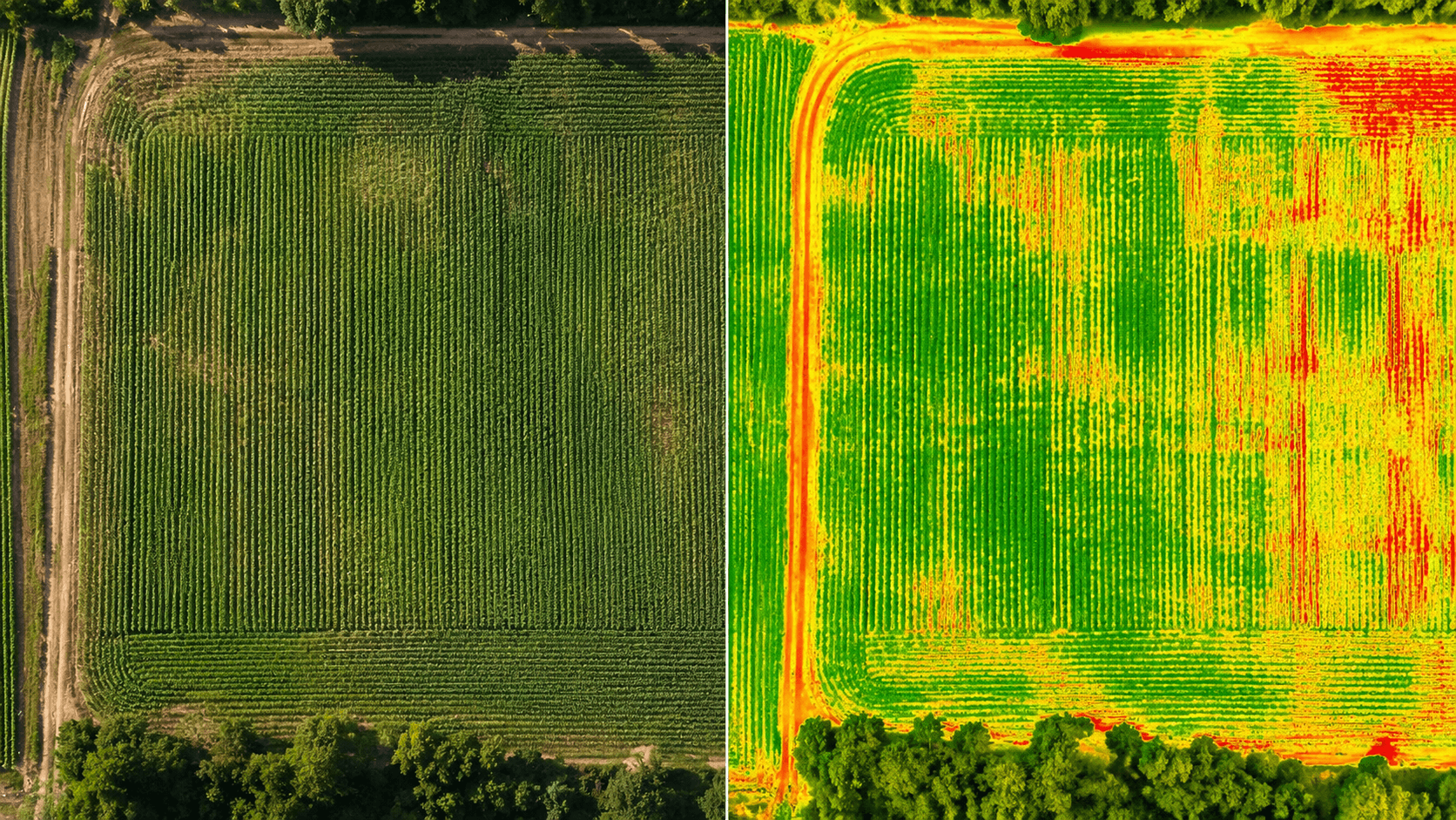
Mapped fields link to available multispectral and remote-sensing observations through external data services. The architecture stays data-source agnostic, so you can add satellite and remote-sensing providers as requirements evolve. Vegetation and field indices support spectral analysis without locking the product to one constellation.

Agricultural intelligence

Decision support grounded in evidence

Shark AERO turns field data from several sources into indicators that support decisions. These outputs are not definitive diagnoses.

01

Irrigation decision support

Soil-moisture and water-stress indicators help users assess irrigation timing. The platform can notify users when conditions suggest that irrigation may be needed; the final decision should also account for field conditions.

02

Crop health monitoring

Remote sensing, field measurements, and historical observations combine to highlight abnormal crop conditions and spatial differences within a parcel.

03

Disease-risk early warning

When environmental and field conditions match patterns linked to higher disease risk, Shark AERO can issue an early warning. It indicates risk conditions. It does not claim definitive plant-disease diagnosis.

04

Soil and plant analysis

Trends, spatial variation, and derived indicators related to soil and vegetation conditions appear as observable history, not invented certainty.

05

Field anomalies

Shark AERO detects unusual changes or within-field differences and brings them forward so you can investigate sooner.

06

Historical intelligence

You interpret current conditions against previous observations, seasons, and events attached to the same field profile.

Alerting

Know when a field needs attention

Shark AERO continuously observes available field information. You do not need to inspect charts all day. The platform can surface irrigation timing, water stress, environmental risk, vegetation anomalies, sensor issues, disease-risk conditions, and weather-related agricultural risks.

Web and mobile

Review fields on web and mobile

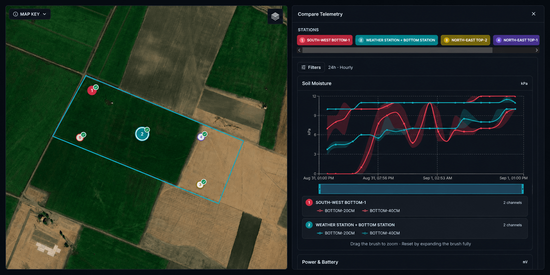
Review field overviews, maps, sensor status, spectral layers, historical graphs, irrigation and crop-health indicators, weather context, device status, and activity timelines on web or mobile. Mobile access fits alerts that arrive when a field needs attention.

Shark AERO

Example notifications

  • 01

    Field conditions indicate irrigation may be required.

  • 02

    Conditions associated with increased disease risk have been detected.

  • 03

    A vegetation anomaly has been detected in Field 04.

Examples for illustration. Actual alerts depend on configured sources, thresholds, and deployment.

Enterprise scale

Deploy the same architecture for institutions

Large farms, irrigation organizations, research institutions, and public-sector agricultural bodies can deploy Shark AERO as a customized, organization-specific system.

  • Organization-specific dashboards and workflows
  • Custom analytics and institutional reporting
  • Dedicated APIs and integration with existing systems
  • Custom field and sensor infrastructure at regional scale
  • Private deployments, on-premise operation, and organization-controlled data environments
  • Isolated installations that do not require Shark Aviation public cloud infrastructure

When data sovereignty and infrastructure ownership matter, Shark AERO can run on customer-controlled environments: dedicated databases, private networks, and on-premise operation.

Explore enterprise deployments

Engage

Discuss your fields and monitoring requirements

Tell us about your fields, monitoring needs, and whether you need a farm-scale or institution-scale deployment. Engineering will follow with a concrete technical path.